Land surveying has evolved dramatically with the advent of drone technology. It’s not just about flying a drone; it’s about choosing the right one that can yield precise data with efficiency and reliability. That’s why I’m here to guide you through the nuances of selecting the best drone for land surveying tasks.
Key Takeaways
- DJI Phantom 4 RTK is a top pick for its balance of cost, ease of use, and precision.
- Endurance and reliability are crucial for survey drones, with battery life being a key factor.
- High-resolution cameras and multispectral sensors are essential for detailed data collection.
- Software compatibility and user-friendly operation should not be overlooked.
- Real-world applications and customer feedback are invaluable for assessing a drone’s performance.
Soaring to New Heights: Top Drones for Land Surveying
As a surveyor, you’re always aiming for the highest level of accuracy. Let’s delve into what makes a drone suitable for this meticulous task. The right drone will have a significant impact on your workflow, data quality, and overall project success.
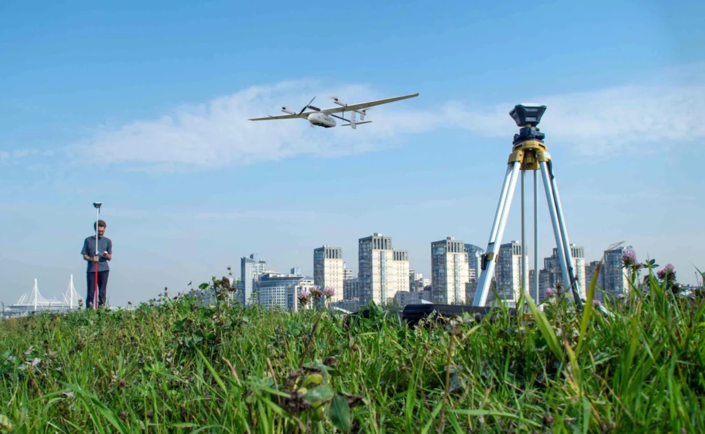
The Role of Drones in Modern Land Surveying
Drones have become indispensable in modern land surveying because they provide a bird’s-eye view of the terrain, which is crucial for creating accurate maps and models. They’re faster, safer, and often more cost-effective than traditional methods. But not all drones are created equal, especially when it comes to surveying.
When we talk about surveying drones, we’re referring to UAVs that are equipped with advanced features like high-resolution cameras, GPS, and reliable flight control systems. These aren’t your average consumer-grade drones; they’re sophisticated tools that require careful consideration before purchase.
Expert Reviews of Leading Survey Drones
In the coming sections, we’ll review the leading survey drones, breaking down their features and real-world applications. This will help you make an informed decision on which drone will serve your surveying needs best.
Accuracy Above All: Surveying Drones Defined
Accuracy is the cornerstone of land surveying. A survey drone must have precise geolocation capabilities, robust data processing, and high-quality imaging to deliver reliable results.
Precision Engineering for Survey Accuracy
The engineering behind a survey drone is what sets it apart. It must be designed to capture data points with pinpoint accuracy. This is achieved through a combination of high-quality sensors, GPS modules, and sophisticated flight control algorithms.
GPS Integration and Positioning Technology
GPS technology is at the heart of drone surveying. It enables drones to navigate and map areas with precision. Look for drones with RTK (Real-Time Kinematic) GPS systems as they can provide centimeter-level accuracy, which is vital for detailed surveys.
The Power of Flight: Drone Endurance and Reliability
Surveying projects can be extensive and demanding. Therefore, the endurance and reliability of a drone are non-negotiable aspects. These factors determine how much ground you can cover and how often you need to pause for battery changes or maintenance.
Maximizing Airtime: Long-Lasting Battery Drones
A drone with a long-lasting battery is a game-changer. It means more time in the air and less time on the ground swapping out batteries or waiting for a recharge. Consider drones that offer at least 30 minutes of flight time to maximize efficiency.
Weathering the Elements: Durability in Surveying Drones
Surveying work doesn’t stop for bad weather. Your drone needs to be able to handle a range of conditions, from high winds to light rain. Durable drones with weather-resistant features will ensure that you can work in less-than-ideal conditions without risking damage to your equipment.
Payload Potential: Carrying the Right Equipment
The payload of a drone refers to the weight it can carry without compromising its flight performance. For surveying, this often means the sensors and cameras necessary for data collection.
Understanding Payload Limits and Options
It’s crucial to understand the payload limits of a drone. You’ll need to balance the weight of the equipment with the drone’s capabilities to ensure it can still perform its tasks effectively.
When considering payload options, take into account the weight of your preferred sensors and cameras, and make sure the drone can carry them with ease. This will prevent any unexpected performance issues during your surveys.
Sensor and Camera Capabilities for Comprehensive Data Collection
The sensors and cameras on a survey drone are its eyes and ears. They capture the data you need to create accurate maps and models. High-resolution cameras are a must for capturing fine details, while multispectral sensors can detect data beyond what the human eye can see, which can be crucial for certain types of surveys.
Crystal Clear Imagery: Drones with Superior Cameras
The imagery your drone captures is only as good as its camera. For land surveying, you’ll need a drone equipped with a camera that can capture high-resolution images. This ensures that every detail of the landscape is recorded, which is essential for accurate surveying.
High-Resolution Cameras for Detailed Surveys
Look for drones with cameras that offer high megapixel counts and large image sensors. These features allow for greater detail in the images captured, which translates to more accurate data for your survey.
Multispectral Sensors: Going Beyond the Visible
Some surveys require more than just visual data. Multispectral sensors can capture information from different parts of the light spectrum, including infrared. This can be invaluable for agricultural surveys, environmental monitoring, and other specialized applications.
User-Friendly Skies: Ease of Use and Accessibility
While technical capabilities are important, the ease of use of a survey drone is equally crucial. A user-friendly drone can save time and reduce the likelihood of errors during operation.
Getting Off the Ground: Easy-to-Operate Drone Models
Look for drones that are known for their intuitive controls and straightforward operation. A user-friendly interface on both the drone and its software will allow for a smoother workflow and quicker data collection.
Software Solutions for Surveying: Compatibility and Support
The software that accompanies your drone is what brings your data to life. It should be compatible with the drone’s hardware and offer robust support for data processing and analysis. Make sure the software is user-friendly and provides the tools you need for your specific surveying tasks.
Chart-Toppers: Best Drones for Land Surveying in 2024
Now, let’s focus on the drones that are making waves in the land surveying industry. These models have been carefully vetted for their capabilities and have proven themselves in the field. They represent a blend of innovation, reliability, and precision that every surveyor should consider.
Feature Analysis of the DJI Phantom 4 RTK
The DJI Phantom 4 RTK is a game-changer in the world of surveying drones. It strikes an excellent balance between cost and performance, offering survey-grade accuracy without breaking the bank. Here’s what sets it apart:
- 1-inch 20-megapixel CMOS sensor for sharp imagery
- RTK module for centimeter-level positioning accuracy
- OcuSync transmission system for seamless communication
- Intuitive flight modes and automated mapping routes
This drone is a solid choice, particularly for those who are venturing into drone surveying for the first time or looking to upgrade from a more basic setup.
Breaking Down the Capabilities of the SenseFly eBee X
For surveyors who require flexibility in their missions, the SenseFly eBee X stands out. It’s designed to adapt to various surveying needs, from agriculture to mining. Noteworthy features include:
- Multiple camera options, including RGB, thermal, and multispectral
- Up to 90 minutes of flight time for covering large areas
- eMotion software for advanced flight planning and data management
- High-precision on-demand RTK/PPK for reliable data capture
It’s a drone that grows with your needs, offering a suite of sensors and software that can be tailored to specific surveying tasks.
Exploring the Robustness of the WingtraOne
The WingtraOne is a vertical take-off and landing (VTOL) drone that combines the convenience of a multirotor with the range of a fixed-wing aircraft. It’s a robust option for surveyors facing challenging terrain or needing to cover vast expanses. Key features include:
- VTOL functionality for easy deployment in varied environments
- High-resolution payloads for detailed imagery and data
- Up to 59 minutes of flight time, ideal for large-scale surveys
- Precision landing technology to safeguard equipment on return
Its hybrid design makes it one of the most versatile drones on the market, capable of delivering high-quality data across diverse surveying scenarios.
The Power and Precision of the Trimble UX5
When it comes to industry standards, the Trimble UX5 is often part of the conversation. It’s built for professionals who demand the utmost in accuracy and reliability. Highlights of the Trimble UX5 include:
- Aerodynamic design for stable flight in all weather conditions
- High-quality camera system for clear, detailed images
- Advanced Trimble Business Center software for comprehensive data analysis
- Automatic flight control and data capture for efficient operation
This drone is a powerhouse, suited for surveyors who tackle complex projects that require meticulous data collection.
Autel Robotics EVO II – Dual’s Surveying Strengths
Lastly, let’s look at the Autel Robotics EVO II – Dual. This drone is unique because it offers both a high-resolution camera and a thermal imaging sensor, making it incredibly versatile. Its main attributes are:
- 8K video resolution for ultra-clear visuals
- Thermal imaging for inspections and environmental monitoring
- 40 minutes of flight time, ensuring productivity
- Omni-directional obstacle avoidance for safer flights
For surveyors who need to conduct surveys that require both visual and thermal data, the EVO II – Dual is an excellent option.
Real-World Reviews: Drone Performance in the Field
While technical specifications are important, nothing beats real-world performance. Let’s hear from those who have put these drones to the test in actual surveying environments.
Customer Feedback on Top Survey Drones
Surveyors who have used the DJI Phantom 4 RTK often praise its ease of use and the quality of data it provides. One surveyor noted, “The RTK system is spot on. We’ve been able to conduct surveys much faster and with fewer ground control points than ever before.”
Users of the SenseFly eBee X appreciate its adaptability and long flight times. “The eBee X has been a workhorse for our team. Its ability to swap payloads makes it perfect for different types of surveys, and the eMotion software is incredibly user-friendly,” shared a professional surveyor.
The WingtraOne’s VTOL capabilities have not gone unnoticed by users. A surveyor working in mountainous regions stated, “The WingtraOne has made it possible to survey areas we couldn’t access before. Its precision and ease of use are unmatched.”
Trimble UX5 users often highlight its robustness and precision. “The UX5 has been a reliable partner in our surveying projects. Its stability in flight and data accuracy are second to none,” remarked a seasoned surveyor.
Those who have chosen the Autel Robotics EVO II – Dual rave about its dual capabilities. “Having both high-resolution and thermal imaging in one drone has opened up new possibilities for our surveys,” said a surveyor specializing in environmental studies.
Professional Insights: Comparing Practical Applications
When you’re on the ground, the theoretical capabilities of a drone can seem distant. That’s why it’s vital to consider how these drones perform in various surveying scenarios. For instance, the DJI Phantom 4 RTK might be the go-to for quick and precise land development surveys, while the SenseFly eBee X excels in agricultural mapping thanks to its multispectral imaging.
The WingtraOne, with its VTOL technology, is a lifesaver in areas with challenging takeoff and landing spaces. Meanwhile, the Trimble UX5 shines in industrial and construction settings due to its robust design and precise data capture. And for those surveying tasks that require night-time or heat signature data, the Autel Robotics EVO II – Dual proves invaluable.
Putting Theory into Practice: Your Surveying Drone Essentials
How to Select the Right Drone for Your Project
Choosing the right drone for your land surveying project doesn’t have to be a daunting task. Start by considering the size and type of the area you’ll be surveying. If you’re working with large, open spaces, a drone with a longer battery life and greater range, like the SenseFly eBee X, might be your best bet. For smaller, more intricate landscapes, a drone with high maneuverability and precision, such as the DJI Phantom 4 RTK, could be more suitable.
Next, think about the data you need to collect. If you require thermal imaging, a drone like the Autel Robotics EVO II – Dual will serve you well. If you’re looking for rich, detailed visuals, prioritize drones with high-resolution cameras. Remember to also factor in the software compatibility—your drone’s software should integrate seamlessly with your existing tools and workflows.
Finally, consider your budget. While it’s tempting to go for the most advanced drone, it’s important to choose one that offers the best value for your specific needs. Don’t forget to account for any additional costs, such as spare batteries, accessories, and software subscriptions.
Setting Up Your Drone: A Step-by-Step Guide
Setting up your drone is a critical step towards successful surveying missions. Here’s a simple guide to get you started:
- Unpack your drone and all its components carefully.
- Charge the batteries fully before the first flight.
- Install any necessary software on your computer or mobile device.
- Calibrate the drone’s sensors and GPS according to the manufacturer’s instructions.
- Conduct a test flight in an open area to familiarize yourself with the controls.
- Plan your survey mission, setting waypoints and flight paths using the drone’s software.
- Ensure you have all necessary permissions and are complying with local regulations.
With these steps complete, you’ll be well on your way to conducting effective and efficient surveying missions.
Frequently Asked Questions
Can I Use an Ordinary Drone for Land Surveying?
While it’s possible to use a consumer-grade drone for basic surveying tasks, professional land surveying requires specialized drones. These drones are equipped with advanced features like high-resolution cameras, precise GPS systems, and robust software that consumer drones simply don’t offer.
How Accurate Are Drone Surveys Compared to Traditional Methods?
Drone surveys can be incredibly accurate, often matching or even surpassing traditional methods. With RTK GPS systems, drones like the DJI Phantom 4 RTK can achieve centimeter-level accuracy. The key to accuracy is not just the drone itself but also the proper planning and execution of the survey.
What Is the Average Cost of a High-Quality Surveying Drone?
The cost of a high-quality surveying drone can vary widely, ranging from a few thousand dollars to tens of thousands, depending on the features and capabilities you require. For example, a drone like the DJI Phantom 4 RTK may cost around $8,000, while a more advanced system like the Trimble UX5 could be upwards of $25,000.
Do I Need Special Permission to Operate a Surveying Drone?
Yes, in many areas, you’ll need to obtain special permission or a license to operate a surveying drone. This often involves passing a knowledge test and registering your drone with the relevant aviation authority. Always check the local regulations in your area before flying.
How Long Does It Take to Learn to Use a Surveying Drone Effectively?
Learning to use a surveying drone effectively can take anywhere from a few days to several weeks, depending on your prior experience with drones and technology. Most modern surveying drones are designed to be user-friendly, and many come with comprehensive tutorials and customer support to help you get up to speed quickly.