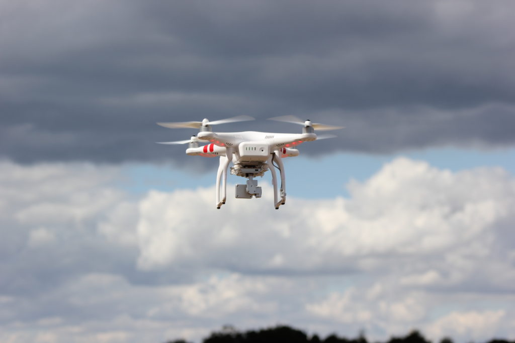
The realm of meteorology stands on the precipice of a revolutionary transformation, all thanks to the advent of Weather Drones. These unmanned aerial vehicles, equipped with a sophisticated array of sensors and instruments, are poised to redefine the way we perceive, analyze, and predict weather patterns. Imagine a fleet of drones soaring through the skies, meticulously gathering real-time data on temperature, humidity, pressure, and wind speed, painting a comprehensive picture of atmospheric conditions like never before. This groundbreaking technology offers unprecedented access to remote and hazardous environments, unlocking new frontiers in meteorological research and analysis. With their ability to navigate diverse weather conditions and altitudes, Weather Drones hold the promise of enhancing the accuracy and reliability of weather forecasting models, thereby empowering meteorologists and emergency responders to make informed decisions in the face of natural disasters and extreme weather events. As we embark on this transformative journey into the realm of Weather Drones, the possibilities are limitless, ushering in a new era of innovation and discovery in the field of meteorology.
Key Takeaways
- Revolutionizing Meteorological Data Collection: Weather Drones represent a paradigm shift in meteorological data collection, offering unparalleled access to remote and hazardous environments, thereby enhancing the accuracy and reliability of weather forecasting models.
- Enhanced Accuracy in Weather Forecasting: With their ability to gather real-time data on atmospheric conditions from various altitudes, Weather Drones contribute to improving the accuracy of weather forecasts, enabling better preparation and response to natural disasters and extreme weather events.
- Versatile Applications Across Industries: Beyond meteorology, Weather Drones find applications in diverse sectors such as disaster response and management, agriculture, and environmental monitoring, showcasing their versatility and potential for addressing multifaceted challenges.
- Regulatory Considerations and Safety Measures: While Weather Drones offer immense benefits, their operation is subject to regulatory frameworks enforced by aviation authorities to ensure safety and responsible stewardship. Adherence to operational guidelines and safety measures is paramount to mitigate risks and ensure the safe deployment of these unmanned aerial vehicles.
- Future Outlook and Collaborative Innovation: Looking ahead, Weather Drones are poised to play an increasingly prominent role in meteorological research, climate studies, and environmental monitoring. Continued innovation, collaboration across interdisciplinary domains, and regulatory reforms are key to unlocking the full potential of Weather Drones for the betterment of society and the planet.
Unprecedented Precision in Data Collection
Advanced Sensor Weather Drones Technology
Weather Drones are equipped with cutting-edge sensor technology that enables precise data collection from various atmospheric layers. These sensors, including temperature, humidity, pressure, and wind speed sensors, provide detailed insights into the complex dynamics of the atmosphere. By leveraging advanced sensor technology, Weather Drones can gather high-resolution data with accuracy and reliability, enhancing the quality of meteorological observations.
The integration of advanced sensor technology allows Weather Drones to capture real-time data with unparalleled precision, offering valuable insights into atmospheric phenomena such as temperature inversions, air pressure gradients, and wind shear. This granular level of detail enables meteorologists to refine weather forecasting models and improve the understanding of localized weather patterns and phenomena.
Remote Sensing Capabilities
Weather Drones possess remote sensing capabilities that enable them to collect data from remote and inaccessible locations. Unlike traditional weather observation methods, which rely on stationary ground-based stations, Weather Drones can penetrate deep into the atmosphere, providing comprehensive coverage of vast geographical areas. This remote sensing capability is particularly valuable in regions with challenging terrain or extreme weather conditions, where conventional observations are limited.
The remote sensing capabilities of Weather Drones facilitate the monitoring of atmospheric parameters in real-time, allowing meteorologists to track weather patterns and phenomena as they unfold. By capturing data from different altitudes and geographical locations, these drones contribute to a more comprehensive understanding of atmospheric dynamics and improve the accuracy of weather forecasts. Moreover, their ability to access remote areas enhances the effectiveness of meteorological research and environmental monitoring efforts.
Rapid Response in Emergency Situations
Disaster Management Support
Weather Drones play a crucial role in disaster management by providing rapid response capabilities during emergencies such as hurricanes, floods, and wildfires. Equipped with real-time data collection capabilities, these drones offer invaluable support to emergency responders and relief agencies by providing situational awareness and critical information for decision-making. In disaster-affected areas where access may be restricted or hazardous, Weather Drones serve as eyes in the sky, helping to assess damage, identify hazards, and coordinate rescue efforts.
During disaster response operations, Weather Drones can be deployed swiftly to assess the extent of damage, monitor changing weather conditions, and identify areas at risk of further impact. This rapid response capability enables emergency responders to prioritize resources effectively, evacuate vulnerable populations, and implement timely mitigation measures. By leveraging the agility and versatility of Weather Drones, disaster management agencies can enhance their preparedness and response capabilities, ultimately saving lives and minimizing the impact of natural disasters.
Search and Rescue Operations Weather Drones
Weather Drones are instrumental in search and rescue operations, where every second counts in locating and aiding individuals in distress. Equipped with high-resolution cameras and thermal imaging technology, these drones can survey vast areas quickly and efficiently, helping rescue teams identify survivors, assess their condition, and coordinate rescue efforts. In remote or inaccessible terrain, such as rugged mountains or dense forests, Weather Drones provide a crucial aerial perspective that complements ground-based search efforts, increasing the likelihood of locating missing persons and expediting rescue operations.
During search and rescue missions, Weather Drones serve as force multipliers, extending the reach of rescue teams and enhancing their situational awareness. By capturing real-time aerial footage and transmitting it to command centers, these drones facilitate rapid decision-making and resource allocation, optimizing search efforts and maximizing the chances of a successful outcome. Moreover, their ability to operate in adverse weather conditions and challenging environments makes Weather Drones indispensable tools for search and rescue teams worldwide.
Precision Agriculture and Crop Monitoring
Optimizing Crop Management Practices
Weather Drones are revolutionizing agriculture by offering precision crop monitoring capabilities. Equipped with multispectral imaging and NDVI (Normalized Difference Vegetation Index) sensors, these drones can assess crop health, detect nutrient deficiencies, and identify areas requiring irrigation or pest control. By providing farmers with actionable insights, Weather Drones enable precise crop management practices, optimizing resource usage and maximizing yields.
Using data collected by Weather Drones, farmers can implement targeted interventions such as variable rate fertilization, precision irrigation, and pest scouting, resulting in improved crop health and productivity. The ability to monitor crops at a high spatial resolution allows farmers to identify issues early and take proactive measures to mitigate risks, ultimately enhancing farm profitability and sustainability.
Remote Sensing for Agricultural Intelligence
Weather Drones leverage remote sensing technology to gather agricultural intelligence, facilitating data-driven decision-making for farmers and agronomists. By capturing aerial imagery and terrain data, these drones provide valuable insights into soil moisture levels, crop growth patterns, and field variability. This information enables farmers to assess field conditions accurately, plan cultivation activities effectively, and optimize resource allocation for maximum efficiency.
With the help of Weather Drones, farmers can monitor crop development throughout the growing season, track changes in vegetation vigor, and assess the impact of environmental factors such as weather events and pest infestations. This real-time agricultural intelligence empowers farmers to make informed decisions on crop rotation, planting schedules, and harvest timing, leading to improved crop quality and yield stability. By harnessing the power of remote sensing technology, Weather Drones are driving innovation in precision agriculture, paving the way for sustainable and resilient farming practices.
Environmental Monitoring and Conservation
Assessing Air Quality and Pollution Levels
Weather Drones play a vital role in environmental monitoring by providing real-time data on air quality and pollution levels. Equipped with gas sensors and particulate matter detectors, these drones can detect pollutants such as ozone, nitrogen dioxide, and particulate matter, offering valuable insights into air quality trends and pollution hotspots. By monitoring air pollution levels, Weather Drones support efforts to mitigate environmental impacts and safeguard public health.
Using data collected by Weather Drones, environmental agencies and researchers can assess the effectiveness of air quality management strategies, identify sources of pollution, and develop targeted interventions to reduce emissions. By leveraging the agility and versatility of Weather Drones, environmental monitoring efforts can be expanded to cover large geographical areas and inaccessible terrain, providing comprehensive insights into air quality dynamics and supporting evidence-based policy decisions.
Monitoring Ecosystem Health and Biodiversity
Weather Drones contribute to monitoring ecosystem health and biodiversity by providing aerial surveys of natural habitats and wildlife populations. Equipped with high-resolution cameras and LIDAR (Light Detection and Ranging) sensors, these drones can capture detailed imagery of ecosystems, map habitat structures, and identify species distribution patterns. By monitoring changes in vegetation cover, habitat fragmentation, and wildlife populations, Weather Drones facilitate the conservation and management of natural resources.
Using data collected by Weather Drones, conservation organizations and wildlife agencies can assess the impact of human activities on ecosystems, prioritize conservation efforts, and monitor the effectiveness of protected areas. By providing timely and accurate information on ecosystem health and biodiversity, these drones support initiatives aimed at preserving biodiversity, restoring degraded habitats, and mitigating the impacts of climate change. With their ability to access remote and inaccessible areas, Weather Drones are invaluable tools for monitoring and safeguarding our planet’s precious natural resources.
Regulatory Framework and Safety Compliance
Adherence to Aviation Regulations
Weather Drones are subject to stringent aviation regulations enforced by civil aviation authorities worldwide. These regulations govern various aspects of drone operation, including registration, pilot certification, airspace restrictions, and safety protocols. By complying with aviation regulations, operators ensure the safe and responsible use of Weather Drones, minimizing the risk of accidents and ensuring public safety.
Operators of Weather Drones must undergo training and certification to operate drones safely and legally. Training programs cover topics such as flight operations, emergency procedures, and airspace regulations, equipping operators with the knowledge and skills needed to conduct drone missions safely and effectively. Additionally, operators must adhere to operational guidelines and safety protocols to mitigate risks and ensure compliance with regulatory requirements.
Safety Measures and Risk Mitigation
Safety is paramount in Weather Drone operations, and operators implement various measures to mitigate risks and ensure safe operation. Pre-flight checks and inspections are conducted to ensure that drones are in proper working condition and that all systems are functioning correctly. During flight operations, operators monitor weather conditions, airspace traffic, and environmental factors to avoid hazards and maintain safe distances from obstacles.
Weather Drones are equipped with collision avoidance systems and fail-safe mechanisms to prevent mid-air collisions and mitigate the risk of accidents. These systems use sensors, GPS, and onboard computers to detect and avoid obstacles, ensuring safe navigation during flight. Additionally, emergency procedures and contingency plans are in place to address unforeseen circumstances and ensure the safe recovery of drones in case of emergencies.
Future Innovations and Collaborative Research
Advancements in Drone Technology
The future of Weather Drones holds exciting possibilities, with ongoing advancements in drone technology driving innovation and enhancing capabilities. Researchers and engineers are exploring new sensor technologies, lightweight materials, and energy-efficient propulsion systems to improve drone performance and extend operational endurance. These advancements promise to expand the scope and versatility of Weather Drones, opening up new opportunities for scientific research and commercial applications.
Interdisciplinary Collaboration and Knowledge Sharing
Collaboration across interdisciplinary domains is key to unlocking the full potential of Weather Drones and addressing complex challenges in meteorology, environmental science, and beyond. Researchers, policymakers, industry stakeholders, and academic institutions collaborate to share knowledge, expertise, and resources, fostering innovation and driving progress in drone technology and applications. By pooling resources and expertise, collaborative initiatives accelerate the development and adoption of Weather Drones, paving the way for transformative solutions to pressing global challenges.
Advantages:
- Enhanced Data Accuracy: Weather Drones collect real-time data with precision, offering accurate insights into atmospheric conditions and improving the reliability of weather forecasting models.
- Remote Monitoring: Weather Drones can access remote and hazardous environments, providing valuable data from areas inaccessible to traditional observation methods.
- Rapid Response: During emergencies, such as natural disasters, Weather Drones offer rapid response capabilities, providing critical information to emergency responders for timely decision-making.
- Versatile Applications: Beyond meteorology, Weather Drones find applications in agriculture, environmental monitoring, disaster management, and scientific research, showcasing their versatility and utility across diverse sectors.
- Cost-Effective: Weather Drones offer cost-effective solutions for data collection compared to manned aircraft or ground-based stations, reducing operational costs and resource requirements.
- Environmental Monitoring: Weather Drones contribute to environmental monitoring efforts by assessing air quality, monitoring wildlife habitats, and detecting pollution levels, aiding conservation and sustainability initiatives.
Disadvantages:
- Regulatory Compliance: Weather Drone operations are subject to stringent aviation regulations and airspace restrictions, requiring operators to navigate complex legal frameworks and obtain necessary permits.
- Safety Concerns: Despite safety measures, Weather Drones pose risks of mid-air collisions, equipment malfunctions, and accidents, raising concerns about public safety and property damage.
- Limited Endurance: Weather Drones have limited flight endurance due to battery constraints, restricting their operational range and duration, especially in remote or inaccessible areas.
- Data Processing Complexity: Managing and processing large volumes of data collected by Weather Drones can be challenging, requiring sophisticated algorithms and computational resources for analysis.
- Privacy Issues: The use of Weather Drones for aerial surveillance raises privacy concerns, as drones may inadvertently capture sensitive information or intrude on individuals’ privacy rights.
- Weather Dependency: Weather Drones are susceptible to adverse weather conditions, such as strong winds, storms, and precipitation, which can affect their flight stability and data collection capabilities.
FAQs
- How do Weather Drones collect data? Weather Drones collect data using a combination of onboard sensors, including temperature, humidity, pressure, and wind speed sensors. These sensors measure various atmospheric parameters, which are then transmitted to ground stations for analysis.
- What are the benefits of using Weather Drones in meteorology? The benefits of using Weather Drones in meteorology include improved data collection in remote or hazardous environments, enhanced accuracy of weather forecasting models, and increased understanding of atmospheric processes.
- Do aviation authorities regulate Weather Drones? Weather Drones are subject to regulations enforced by aviation authorities to ensure safe and responsible operation. These regulations govern drone registration, pilot certification, and airspace restrictions.
- How long can Weather Drones operate in the air? The operational endurance of Weather Drones varies depending on factors such as battery capacity, payload weight, and weather conditions. On average, Weather Drones can typically operate for several hours on a single charge.
- What measures are in place to ensure the safety of Weather Drone operations? Safety measures for Weather Drone operations include pre-flight checks, airspace monitoring, collision avoidance systems, and emergency procedures. Additionally, operators adhere to strict operational guidelines and protocols to minimize risks.
- How are Weather Drones contributing to climate research? Weather Drones contribute to climate research by collecting data on atmospheric conditions, greenhouse gas concentrations, and aerosol particles. This data aids scientists in studying climate change impacts and developing mitigation strategies.
Conclusion
In conclusion, Weather Drones represent a transformative innovation in meteorological data collection, offering unprecedented capabilities for monitoring and understanding the Earth’s atmosphere. With their ability to access remote locations, gather real-time data, and contribute to diverse applications, these unmanned aerial vehicles are reshaping the landscape of meteorology and environmental science. As we embrace the potential of Weather Drones, it is imperative to foster collaboration, innovation, and responsible stewardship to harness their benefits for the betterment of society and the planet.