Welcome to the fascinating world of surveying drones, where cutting-edge technology meets the boundless expanse of the sky to redefine the way we map and understand our planet’s surface. Surveying drones, also known as UAVs (Unmanned Aerial Vehicles), have emerged as indispensable tools in various industries, offering unparalleled capabilities in data collection, analysis, and visualization.
These advanced aerial devices are equipped with an array of sophisticated sensors, including high-resolution cameras, LiDAR (Light Detection and Ranging) scanners, and GPS systems, enabling them to capture detailed imagery and geospatial data with unprecedented accuracy and efficiency. From construction and agriculture to environmental monitoring and emergency response, surveying drones are revolutionizing the way we approach tasks that once seemed daunting and time-consuming.
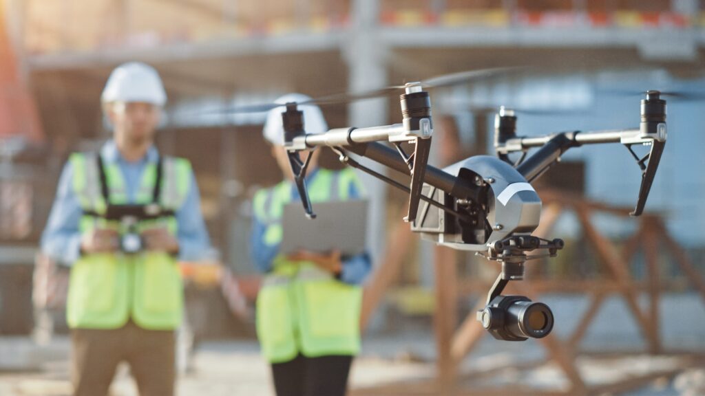
With their ability to fly autonomously or be remotely piloted by skilled operators, surveying drones provide a bird ‘ s-eye view of the world below, offering insights that were previously inaccessible or prohibitively expensive to obtain. Whether mapping terrain, monitoring crop health, or assessing disaster damage, these versatile aerial platforms empower industries and organizations to make informed decisions, optimize processes, and drive innovation forward in a rapidly evolving landscape. Join us as we embark on a journey to explore the myriad applications and transformative potential of surveying drones in shaping the future of our planet’s spatial intelligence.
Key Takeaways
- Precision and Efficiency: Surveying drones offer unparalleled precision and efficiency in land mapping and data collection, thanks to their advanced sensors and aerial capabilities.
- Versatility Across Industries: From construction and agriculture to environmental monitoring and emergency response, surveying drones finds applications across diverse industries, reshaping workflows and enhancing outcomes.
- Cost Savings and Time Efficiency: By streamlining processes, improving safety, and reducing manual labor, surveying drones deliver significant cost savings and time efficiency to businesses and organizations.
- Data-Driven Decision Making: With their ability to capture high-resolution imagery and geospatial data, surveying drones empower users to make data-driven decisions, optimize resource allocation, and mitigate risks.
- Future Potential: As technology continues to evolve and innovation drives progress, the potential applications of surveying drones are limitless, promising a future where precision, efficiency, and sustainability converge to address complex challenges and unlock new opportunities.
Advantages of Surveying Drones
Cost Savings
Surveying drones offer significant cost savings compared to traditional surveying methods. In the past, land surveys often required extensive manpower, specialized equipment, and lengthy fieldwork, all of which contributed to high operational costs. However, with the advent of surveying drones, many of these expenses have been greatly reduced or eliminated.
One of the primary cost-saving benefits of surveying drones is their ability to cover large areas in a fraction of the time it would take traditional surveying teams. By autonomously flying predefined routes and capturing high-resolution imagery, drones can complete surveys in a matter of hours that would have taken days or even weeks using conventional methods. This increased efficiency translates directly into cost savings for businesses and organizations, as fewer resources are required to complete the same tasks in less time.
Additionally, surveying drones require minimal manpower to operate, further reducing labor costs associated with surveying projects. With advancements in automation and remote piloting technology, a single operator can control multiple drones simultaneously, maximizing productivity and minimizing personnel expenses. Overall, the cost savings offered by surveying drones make them an attractive option for businesses looking to optimize their surveying processes and maximize their return on investment.
Enhanced Safety
Safety is paramount in any surveying operation, and surveying drones offer several advantages in this regard. Traditional surveying methods often involve working in hazardous or hard-to-reach environments, exposing surveyors to risks such as falls, accidents, and adverse weather conditions. Surveying drones mitigate these risks by eliminating the need for surveyors to physically access difficult terrain or hazardous sites.
By capturing data from the air, surveying drones keep surveyors safely out of harm’s way while still providing detailed and accurate survey data. This not only protects surveyors from potential injuries but also reduces the likelihood of costly accidents and delays that can result from on-site mishaps. Additionally, surveying drones can be equipped with obstacle detection and avoidance systems, further enhancing their safety features and reducing the risk of collisions during flight.
Overall, the enhanced safety provided by surveying drones not only protects surveyors and personnel but also minimizes project risks and liabilities for businesses and organizations. By leveraging drone technology, surveying operations can be conducted more safely and efficiently, ensuring that projects are completed on time and within budget while prioritizing the well-being of all involved parties.
Precision Mapping Capabilities
High-Resolution Imaging
Surveying drones are equipped with advanced cameras capable of capturing high-resolution imagery with exceptional detail and clarity. These cameras utilize state-of-the-art sensors and lenses to capture images with resolutions ranging from several megapixels to tens of megapixels, depending on the specific drone model and configuration.
The high-resolution imagery captured by surveying drones provides surveyors with a wealth of visual data that can be used to create detailed maps, identify features, and analyze terrain characteristics. From detecting subtle changes in elevation to identifying small objects or structures, the level of detail captured by surveying drones far surpasses what is possible with traditional surveying methods.
One of the key advantages of high-resolution imaging is its ability to provide accurate and up-to-date information about the surveyed area. By capturing imagery from multiple angles and perspectives, surveying drones can create comprehensive maps that accurately reflect the current state of the terrain. This is particularly useful in dynamic environments where conditions may change rapidly, such as construction sites or natural disaster zones.
LiDAR Technology
In addition to high-resolution imaging, many surveying drones are equipped with LiDAR (Light Detection and Ranging) technology, further enhancing their mapping capabilities. LiDAR works by emitting laser pulses and measuring the time it takes for them to return after bouncing off objects in the environment. This allows the drone to generate precise 3D models of the terrain, including elevation data and surface features.
LiDAR technology offers several advantages over traditional surveying methods, including its ability to penetrate vegetation and other obstacles to capture detailed data about the underlying terrain. This makes LiDAR particularly useful for mapping densely forested areas, urban environments, and other complex landscapes where traditional surveying techniques may be impractical or ineffective.
By combining high-resolution imaging with LiDAR technology, surveying drones can create highly accurate and detailed maps that provide invaluable insights for a wide range of applications. Whether used for urban planning, infrastructure development, environmental monitoring, or disaster response, the precision mapping capabilities of surveying drones are transforming the way we understand and interact with the world around us.
Versatility Across Industries
Construction
Surveying drones have revolutionized the construction industry by streamlining processes, enhancing safety, and reducing costs. In construction projects, drones are used for site surveys, progress monitoring, and quality control. By capturing aerial imagery and data, drones provide construction teams with real-time insights into project status, allowing for better decision-making and more efficient resource allocation.
Drones are particularly valuable in large-scale construction projects where the terrain may be complex or difficult to access. By flying over the site and capturing detailed imagery, drones can identify potential obstacles, track progress, and detect discrepancies between the planned design and the actual construction. This proactive approach helps to minimize errors, reduce rework, and ensure that projects stay on schedule and within budget.
Agriculture
In agriculture, surveying drones play a crucial role in precision farming practices, enabling farmers to optimize crop yields, reduce input costs, and minimize environmental impact. By capturing aerial imagery of fields and crops, drones provide farmers with valuable insights into crop health, nutrient levels, and irrigation needs. This allows farmers to make data-driven decisions about planting, fertilization, and pest control, ultimately leading to higher yields and greater profitability.
Surveying drones are also used in environmental monitoring and conservation efforts. From assessing deforestation and wildlife habitats to monitoring coastline erosion and pollution levels, drones provide researchers and conservationists with real-time data for informed decision-making and proactive interventions.
Emergency Response
In emergency response scenarios such as natural disasters or search-and-rescue operations, surveying drones offer rapid aerial reconnaissance capabilities. Equipped with thermal imaging cameras and advanced sensors, drones can quickly assess damage, locate survivors, and support relief efforts in challenging terrain and conditions.
By providing first responders with real-time situational awareness, surveying drones helps to coordinate rescue efforts, prioritize resources, and save lives. Additionally, drones can be used to assess infrastructure damage, identify hazardous areas, and plan evacuation routes, ensuring that emergency response efforts are efficient and effective.
Overall, the versatility of surveying drones across industries highlights their transformative potential and underscores the importance of embracing drone technology to drive innovation and address complex challenges in today’s rapidly changing world.
Regulatory Compliance and Best Practices
Aviation Regulations
The use of surveying drones is subject to regulations set forth by aviation authorities and government agencies, which may vary depending on location and intended use. Compliance with airspace regulations, privacy laws, and safety guidelines is essential for legal and responsible drone operations.
Aviation regulations typically govern aspects such as drone registration, pilot certification, airspace restrictions, and operational limitations. Before conducting any surveying activities with drones, it is crucial to familiarize oneself with the relevant regulations and ensure full compliance to avoid fines, penalties, or legal liabilities.
Safety Protocols
Implementing robust safety protocols is essential to mitigate risks associated with surveying drone operations. This includes conducting pre-flight checks to ensure the drone is in optimal condition, verifying airspace clearance, and assessing weather conditions for safe flying.
Additionally, establishing clear communication protocols among drone operators, ground personnel, and other stakeholders is essential to maintain situational awareness and prevent accidents. By adhering to safety best practices and guidelines, surveying drone operations can be conducted safely and efficiently, minimizing the risk of injuries, property damage, or regulatory violations.
Future Trends and Innovations
Artificial Intelligence Integration
The integration of artificial intelligence (AI) technologies is poised to revolutionize the capabilities of surveying drones. AI algorithms can analyze vast amounts of data collected by drones to identify patterns, detect anomalies, and extract actionable insights automatically.
By leveraging AI-powered analytics, surveying drones can provide more intelligent and predictive data analysis, enabling users to make informed decisions faster and more accurately. This trend towards AI integration is expected to further enhance the efficiency, accuracy, and versatility of surveying drone applications across various industries.
Beyond Visual Line of Sight (BVLOS) Operations
Advancements in drone technology and regulatory frameworks are paving the way for Beyond Visual Line of Sight (BVLOS) operations, where drones can fly beyond the operator’s direct line of sight. BVLOS operations offer expanded capabilities and opportunities for surveying drones, allowing them to cover larger areas and access remote or inaccessible locations more effectively.
By enabling BVLOS operations, surveying drones can unlock new possibilities for applications such as pipeline inspections, wildlife monitoring, and infrastructure maintenance. However, BVLOS operations also present challenges related to safety, airspace management, and regulatory compliance, which must be addressed through ongoing research, collaboration, and innovation.
Advantages:
- Precision Mapping: Surveying drones offer highly accurate and detailed mapping capabilities, allowing for precise measurement and analysis of terrain and structures.
- Cost Savings: Compared to traditional surveying methods, drones are more cost-effective, requiring fewer resources and less manpower to complete surveys.
- Time Efficiency: Drones can cover large areas in a fraction of the time it takes traditional surveying teams, speeding up project timelines and improving productivity.
- Enhanced Safety: By keeping surveyors out of hazardous or hard-to-reach areas, drones minimize the risk of accidents and injuries, improving overall safety on-site.
- Versatility: Surveying drones can be used across various industries, including construction, agriculture, environmental monitoring, and emergency response, making them versatile tools for a wide range of applications.
- Data Accuracy: With advanced sensors and imaging technology, drones capture high-resolution imagery and geospatial data, ensuring accurate and reliable results for decision-making.
Disadvantages:
- Regulatory Compliance: Operating surveying drones requires compliance with aviation regulations, airspace restrictions, and privacy laws, which can be complex and time-consuming to navigate.
- Weather Dependency: Adverse weather conditions such as rain, wind, or fog can affect drone operations, limiting their usability and potentially delaying projects.
- Technical Challenges: Maintaining and troubleshooting drone equipment requires technical expertise, and malfunctions or technical issues can disrupt surveying operations.
- Data Processing: Processing and analyzing the large amounts of data collected by drones can be time-consuming and resource-intensive, requiring specialized software and skills.
- Limited Payload Capacity: Drones have limited payload capacity, which can restrict the types of sensors and equipment that can be carried, limiting their capabilities for certain applications.
- Privacy Concerns: Drones equipped with cameras raise privacy concerns, as they have the potential to capture images or footage of individuals without their consent, leading to privacy violations or legal issues.
Frequently Asked Questions (FAQs)
- What are the primary benefits of using surveying drones? Surveying drones offers numerous benefits, including cost savings, time efficiency, improved safety, and enhanced data accuracy.
- How do surveying drones contribute to environmental conservation? Surveying drones enable environmentalists to monitor ecosystems, track wildlife populations, assess habitat health, and detect environmental threats with unprecedented accuracy and efficiency.
- Are surveying drones difficult to operate? Modern surveying drones are equipped with user-friendly interfaces and automated flight modes, making them accessible to users with varying levels of experience. However, proper training and adherence to regulations are essential for safe and effective operation.
- Can surveying drones operate in adverse weather conditions? While surveying drones are capable of operating in a wide range of weather conditions, including rain and wind, extreme weather may pose challenges and necessitate precautionary measures to ensure safe operation and data integrity.
- What regulations govern the use of surveying drones? The use of surveying drones is subject to regulations set forth by aviation authorities and government agencies, which may vary depending on location and intended use. Compliance with airspace regulations, privacy laws, and safety guidelines is essential for legal and responsible drone operations.
- How can I integrate surveying drones into my business or industry? To integrate surveying drones into your business or industry, consider factors such as workflow integration, data management, training requirements, and regulatory compliance. Collaborating with experienced drone service providers or investing in in-house drone capabilities can help maximize the benefits of drone technology for your organization.
Conclusion
Surveying drones represent a paradigm shift in land mapping and spatial data collection, offering unparalleled precision, efficiency, and versatility across diverse industries. From construction and agriculture to environmental conservation and emergency response, the applications of surveying drones are vast and transformative. Embracing drone technology empowers organizations to unlock new insights, optimize operations, and drive sustainable growth in an increasingly interconnected world.
Leave a Reply