Key Takeaways
- Drones offer unparalleled efficiency in surveying, covering large areas quickly and reducing data collection time.
- High-resolution imagery from drones leads to more accurate data, enhancing the precision of surveys.
- Using drones for surveying improves safety by allowing surveyors to assess hazardous areas remotely.
- Drone surveying is cost-effective, potentially saving thousands of dollars in traditional surveying expenses.
- Drones can access difficult terrain, providing valuable data that was previously challenging to obtain.
Flying into the Future: How Drones Are Changing the Game in Construction Surveying
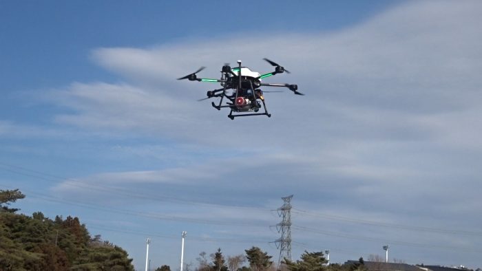
Imagine capturing a bird’s-eye view of a sprawling construction site, with every detail in crystal-clear resolution, all without leaving the ground. This isn’t just a flight of fancy; it’s the reality of modern drone surveying. By embracing drone technology, professionals in construction surveying are revolutionizing how they gather data, assess project progress, and ensure the safety of their teams.
Drones vs Traditional Methods: A Quick Comparison
Let’s lay the groundwork by understanding how drones stack up against traditional surveying methods:
| Traditional Surveying | Drone Surveying |
|---|---|
| Time-consuming data collection | Rapid data acquisition |
| Lower-resolution data | High-resolution imagery |
| Manual access to hazardous areas | Remote assessment of risk zones |
| High labor and equipment costs | Reduced surveying expenses |
| Limited by difficult terrain | Superior access to challenging landscapes |
As you can see, drone surveying isn’t just an alternative to traditional methods; it’s a significant upgrade in many respects.
Key Advancements in Drone Technology for Surveying
Drone technology has surged forward with innovations that specifically benefit surveying. Most importantly, these advancements include:
- Enhanced GPS systems for pinpoint location accuracy.
- Improved camera resolutions for detailed imaging.
- Automated flight paths for consistent data collection.
- Advanced sensors, like LiDAR, for 3D mapping.
- Greater battery life for extended flight times.
Because of these technological leaps, drones are now indispensable tools in the surveyor’s kit.
Ensuring Safety on the Site
Safety is paramount on any construction site, and drone surveying contributes significantly to this aspect.
How Drones Keep Surveyors Out of Harm’s Way
Traditional surveying often requires personnel to navigate treacherous terrain or enter zones that might be unsafe due to ongoing construction or natural hazards. Drones eliminate the need for surveyors to physically access these areas, significantly reducing the risk of accidents and injuries.
Assessing Risky Areas Without Risk
Drones can be piloted remotely, soaring over unsafe zones while the surveyor remains at a safe distance. This capability is not only safer but also allows for the assessment of areas that might have been previously off-limits due to safety concerns.
For example, consider a steep, unstable hillside that’s prone to landslides. Sending a survey team up there would be risky, but a drone can fly over and collect the necessary data without a hitch. This not only keeps the team safe but also ensures that the project has the data needed to proceed with confidence.
Cost-Effective Aerial Accuracy
When it comes to surveying, accuracy is not just about getting the measurements right; it’s also about the economic impact. Drone technology brings a level of precision that was once cost-prohibitive or outright impossible with traditional methods. This precision directly translates to cost savings in both the short and long term.
Trimming the Budget with Drone Technology
Drone surveying slashes budgets in several ways. Firstly, the time saved in data collection and processing means less manpower is required. Secondly, the reduction in the need for heavy machinery and equipment on site lowers rental and transportation costs. Lastly, the enhanced accuracy provided by drones can prevent costly mistakes and reworks.
Let’s break this down: traditionally, a surveyor might spend several days or weeks mapping out a large area, but a drone can accomplish the same task in a matter of hours. Moreover, the data captured by drones is not only gathered more quickly but is also richer in detail, providing a better foundation for decision-making.
Consider the case where a construction project needs to map out a 20-acre plot. Traditionally, this could cost tens of thousands of dollars and take weeks to complete. With a drone, the same job could be done in a day, with expenses reduced to a fraction of the cost.
By employing drones, we’re not just trimming the fat from our budgets; we’re delivering a leaner, more efficient surveying process that benefits the entire project lifecycle.
High-Resolution Imagery for Precise Measurements
Drones equipped with high-resolution cameras and sensors capture images and data with an unprecedented level of detail. This capability ensures that measurements are incredibly precise, which is crucial for planning and executing construction projects. Accurate data helps in creating reliable blueprints and in anticipating potential issues before they become expensive problems.
Reaching New Heights: Access Unparalleled
Drones are not bound by the same limitations as humans or ground-based machinery. They can soar to new heights and dip into previously inaccessible areas with ease, offering a perspective that was once unattainable.
Tackling Tough Terrain with Ease
Surveying rugged landscapes, dense forests, or active construction sites is no longer a logistical nightmare. Drones glide over these terrains, capturing data without disturbing the environment or risking crew safety. This ability to tackle tough terrain with ease is one of the standout features of drone surveying.
Surveying the Previously Unsurveyable
There are places where traditional survey methods cannot reach or would be too costly to attempt. Drones have opened up possibilities to survey these areas, such as remote mountain ranges, expansive deserts, and vast wetlands. This has not only expanded the scope of what can be surveyed but has also enriched the data pool available to professionals.
For instance, a project that requires environmental impact assessments in a remote location can now proceed with a comprehensive set of data that would have been too perilous or expensive to collect before drones came into the picture.
Applications of Drone Surveying in Construction
The applications of drone surveying in construction are as diverse as they are impactful. From the initial planning stages to the final touches, drones play a vital role in ensuring projects are completed to the highest standards.
Initial Site Analysis and Ongoing Project Tracking
Before the first shovel hits the ground, drones can provide a detailed analysis of the site, identifying potential issues and helping to plan the most effective construction approach. As the project progresses, drones offer a way to track developments, ensuring that everything is proceeding according to plan.
Volume Calculations for Stockpiles and Excavations
Calculating the volume of stockpiles and excavations can be time-consuming and fraught with error when done manually. Drones simplify this process, providing accurate measurements that are vital for project management and financial planning.
Embracing the Drone Revolution
Adopting drone technology is not just about keeping up with the times; it’s about staying ahead of the curve. The benefits of drone surveying are clear, and professionals who incorporate this technology into their workflows will enjoy a competitive edge.
Getting Started with Drone Surveying in Your Projects
Integrating drones into your surveying projects is easier than you might think. Start by identifying the areas where drone surveying can have the most impact. Then, invest in the right equipment or partner with a drone surveying service. Finally, train your team or work with experienced pilots to ensure you’re getting the most out of this revolutionary technology.
The future is not on the horizon; it’s here, reshaping our skies and the way we map our earth. The drone revolution in surveying is not coming—it has arrived. Professionals who harness the power of this technology will not only streamline their operations but will also provide their clients with insights and precision that were once deemed impossible.
Embracing drone technology is not about discarding traditional methods; it’s about enhancing them. It’s about making the leap from what’s tried-and-true to what’s efficient and revolutionary. If you’re ready to make that leap, start by exploring the types of drones best suited for your surveying needs, and consider the regulations and training that will be part of your journey into the future of surveying.
Remember, the goal is not just to follow trends but to set them. By integrating drones into your surveying practices, you’re not just adopting new technology—you’re pioneering a new standard in construction and surveying excellence.
The Future Is Here: Integrating Drones into Your Workflow
So, how do you begin integrating drones into your workflow? First, understand the specific needs of your projects and how drones can meet them. Next, choose the right drone and sensor technology to ensure you get the data quality you require. And don’t forget to consider the training or hiring of skilled pilots who can maneuver these sophisticated machines with precision.
Once you have these elements in place, start small. Pilot a drone surveying project on a smaller scale before rolling it out to larger projects. This will allow you to see the benefits first-hand and adjust your processes as needed. Most importantly, keep an eye on evolving drone technology and regulations to ensure your operations remain cutting-edge and compliant.
FAQs
As we delve into the world of drone surveying, questions naturally arise. Let’s address some of the most common inquiries to clear the air and provide clarity.
What Is the Primary Advantage of Using Drones for Surveying?
The primary advantage of using drones for surveying is the combination of speed, safety, and accuracy they offer. Drones can survey large areas in a fraction of the time it would take a ground crew, and they do so with remarkable precision. Moreover, they keep surveyors safe by eliminating the need to physically access dangerous or difficult-to-reach areas.
Can Drone Surveying Replace Traditional On-the-Ground Techniques?
While drone surveying is transformative, it’s not a total replacement for on-the-ground techniques. Instead, it’s a complementary tool that enhances traditional methods. There are still scenarios where ground-based surveying is necessary or more practical, but drones provide a valuable alternative when traditional methods are too slow, risky, or expensive.
How Accurate Are Drone Surveys Compared to Traditional Methods?
Drone surveys can be incredibly accurate, often matching or even surpassing traditional methods. The key is in the technology used. Drones equipped with high-end cameras, GPS, and LiDAR systems can capture detailed images and generate precise measurements that are invaluable for construction and surveying projects.
Consider a scenario where a drone equipped with a LiDAR sensor maps a forested area. The LiDAR can penetrate the canopy and reach the ground, providing topographical data that would be extremely difficult to obtain through ground surveying alone.
Are There Legal Requirements for Flying Drones for Surveying Purposes?
Yes, there are legal requirements for flying drones, especially for commercial purposes such as surveying. These regulations vary by country and sometimes even by region within a country. It’s crucial to understand and comply with these regulations, which often include pilot certification, drone registration, and adherence to specific flight rules.
How Can Construction Professionals Stay Current with Advancements in Drone Technology?
To stay current with advancements in drone technology, professionals should:
- Subscribe to industry publications and online forums.
- Attend trade shows and workshops focused on drone technology.
- Engage with professional networks and associations.
- Participate in training programs to learn about new features and capabilities.
- Collaborate with technology providers to understand the latest offerings.
Staying informed is crucial as drone technology continues to evolve rapidly, and keeping pace with these changes will ensure that your surveying practices remain at the forefront of the industry.